4 Discussion
Each season of fieldwork was unique, thus we will discuss them individually.
4.1 2021
4.1.1 2021 Anadromous habitat surveys
In summer 2021 we surveyed sites primarily in the region North of Kenai/Soldotna within an hour’s walking distance of the road system.
Survey site selections were made by visually assessing the superimposed map layers of the Anadromous Waters Catalog with the USGS National Hydrography Database (NHD)1. In areas where previously documented anadromous stream or lake extents ended but connected water bodies continued upstream, we targeted sites suitable for minnow trapping.
At most sites surveyed in 2021, we captured primarily non-anadromous species such as stickleback and sculpin. We also captured some resident salmonid species such as Dolly Varden and Rainbow Trout.
These results supported several conclusions that directed fieldwork efforts following summer 2022:
A need exists to refine methods for survey site selection. Relying on visual assessment of overlay between documented AWC habitat and the NHD map is frequently insufficient as a prospecting guide for yet-unidentified anadromous waters. Discussions in Fall 2021 with personnel at ADF&G’s Habitat Division in Anchorage yielded valuable insight and potential for collaboration.
Some drainages in the North Kenai/Nikiski area that may have been historically anadromous have man-made barriers to fish passage that we identified in Summer 2021. One such example was previously undocumented as was discovered by TU volunteers, discussed further in the section below, “Highlight: Habitat Connectivity.” Identifying fish passage barrier sites is a critical first step in determining if restoration is feasible.
4.1.1.1 2021 Highlight: Lower Soldotna Creek Tributary
KWF was notified of a previously undocumented tributary segment in the Soldotna Creek drainage in July 2021. The tributary was documented as anadromous up to a road crossing approximately 100 m upstream from the Soldotna Creek mainstem, but the stream channel continued beyond. The stream segment upstream of the road crossing had been excavated in June 2021 as part of a new residential development project, but it was suspected that the modified channel still supported fish populations. KWF staff placed minnow traps at the most upstream locations where the traps could still be submerged. Over the course of several site visits we captured a total of 65 Coho Salmon and five Dolly Varden.
KWF submitted these data in ADFG’s September 2021 call for data, and documented the approximate paths of existing stream channels, supported by several dozen ground-truthing photos. These data are displayed in the map figure below, and are also accessible at ArcGIS Online2).
The post-hoc documentation of this previously unidentified salmon stream after it has been altered emphasizes the need for continued thorough efforts to document anadromous habitat, particularly in watersheds experiencing growth and development. Communication with property owners remains critical to the task of identifying previously undocumented anadromous habitat.
4.1.2 2021 Highlight: Habitat Connectivity
In two cases where map interpretation suggested presence of salmonids but we captured none, we visited other locations in the watershed where fish barriers may be present. We found evidence of man-made fish barriers at two locations:
Suneva Lake - Suneva Lake lies to the North of Daniels Lake in the Nikiski area. The lake’s surface area is appx 1.0 sq km, and flows directly in to Cook Inlet 0.61 km downstream from the lake outlet. Aerial imagery indicates that littoral is ~95% undeveloped. Littoral parcels are primarily privately owned.
We conducted sampling events on two separate days at Suneva lake. We captured stickleback and sculpin on both occasions, but no salmonids despite extensive effort.
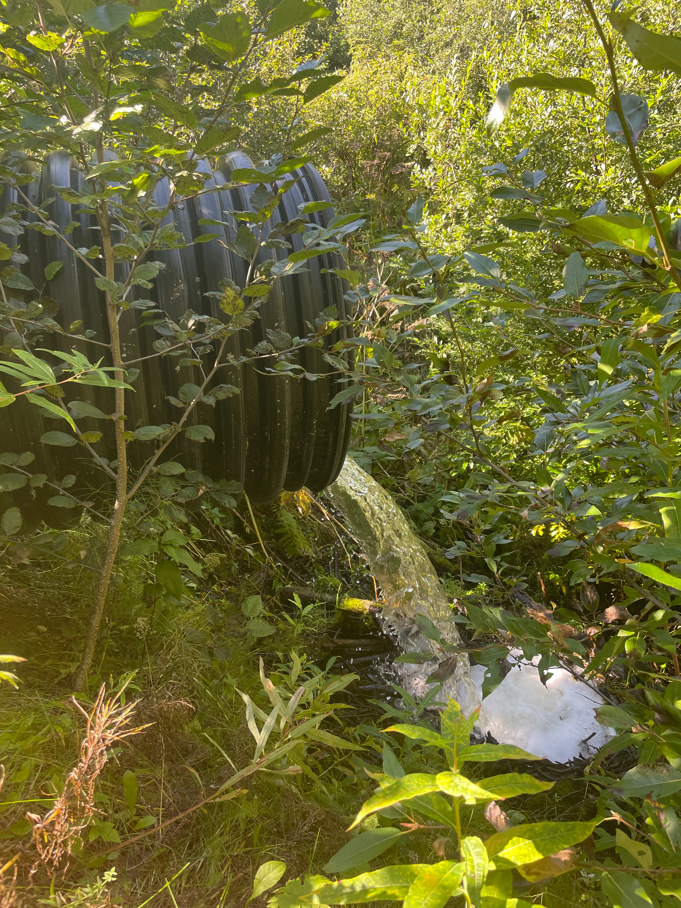
We visited the outlet at Suneva lake and discovered two perched culverts installed where the outlet stream crosses Sockeye Avenue (Figure 4.1). The culvert is likely impeding fish passage, as there is a drop of several feet between the stream channel and the culvert outlet.
A site visit to the mouth of the creek flowing from Suneva Lake at its outlet at Cook Inlet will help determine if the waterway has potential to host anadromous species and may be part of future fieldwork.

Salamatof Creek - Salatamtof Creek lies North of Kenai and South of Nikiski, crossing the Kenai Spur highway. A stream connection of 1.56 km flows from Lower Salamatof Lake to Cook Inlet, and a stream segment of 2.84 km connects the lower lake to Salamatof Lake. We sampled at a site in the stream segment connecting the two lakes on one occasion in Summer 2021 and captured a several hundred sticklebacks, but no salmonids.
We visited the location where maps indicated that Salamatof Creek crosses the Kenai Spur Highway in August 2021 (Figure 4.2).
At the road crossing we observed a culvert passage for Salamatof Creek below the highway, but no flowing water. The visible nearby body of water at this location appeared to be lotic in nature, and no outflow was readily evident.
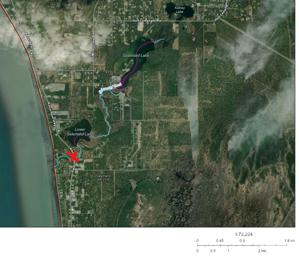
Based on observations at the road crossing, it is possible that historical construction activities altered the flow path of Salamatof Creek such that it no longer connects to Cook Inlet except at very high flow volumes. A review traditional knowledge in this area could help reveal if this watershed may have previously been an anadromous waterbody. Additionally, a review of historical aerial imagery could reveal how channel path or lake acreage extent may have changed in recent decades.
4.1.3 2021 Outreach and other activities
In addition to fieldwork efforts aimed at prospecting for unidentified anadromous waters, having personnel mobilized and trained in juvenile fish identification and capture methods allowed for support in two additional efforts:
Education. In 2021 KWF oversaw 12 fish sampling events aimed exclusively at education and outreach, occurring primarily at Lower Soldotna Creek. These events introduced basic facts about wild salmon life history and habitat to local community members, visitors, journalists, and summer campers. Total participants is estimated in excess of one hundred people.
Culvert replacement. In summer 2021 KWF oversaw construction activities to replace the culvert carrying the North Fork of the Anchor River underneath Niklovaesk road in the Anchor Point area. As part of these efforts, a small segment of river channel is temporarily de-watered thus fish in this segment must be captured and released downstream prior. KWF personnel was able to capture juvenile fish (n = 329) as part of these fish rescue efforts.
4.2 2022
4.2.1 2022 Anadromous Habitat Surveys
In Summer 2022 we focused our survey efforts on streams in the Kenai/Soldotna/Sterling area including Coal Creek, Beaver Creek, and tributaries of the Moose River. Experience from the previous season contributed to much more frequent success of identifying anadromous habitat prior to fieldwork. In 2022, four out of five site visits yielded fish observations used in AWC nominations.
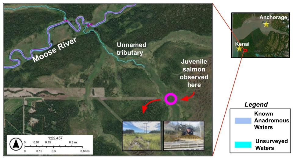
In one case, at the “Moose River Trib 1.4” site, the flow line indicated by the National Hydrography Database stops ~0.3 miles downstream of the location where we captured juvenile coho salmon. Thus, this salmon-bearing location was not only not documented in the Anadromous Waters Catalog, it was not yet documented even as a stream (Figure 4.3.)
These observations highlight the need for a more sophisticated mapping approach to generate survey sites for additional fieldwork. For additional discussion and a plan forward on this topic, see the “Future Directions” chapter.
4.2.2 2022 Outreach and other activities
- Education. In 2022 KWF continued to oversee fish sampling events aimed exclusively at education and outreach, occurring primarily at Lower Soldotna Creek. These events introduced basic facts about wild salmon life history and habitat to local community members, visitors, journalists, and summer campers. Total participants is estimated in excess of one hundred people.
4.3 2023
4.3.1 2023 Anadromous Habitat Surveys
In 2023 we continued to focus on waters near the road system in the central Kenai Peninsula including Soldotna Creek, Moose River, Beaver Creek, and smaller unnamed tributaries of the lower main stem Kenai River. In 2023 nearly all sites that we surveyed revealed the presence of previously undocumented juvenile anadromous fish.
As presented in the results section, steadily increasing volunteer participation tracked closely with an increasing number of nominations.
4.3.2 2023 Outreach and other activities
- Education. In 2023 KWF continued to oversee fish sampling events aimed exclusively at education and outreach, occurring primarily at Lower Soldotna Creek. These events introduced basic facts about wild salmon life history and habitat to local community members, visitors, journalists, and summer campers. Total participants is estimated in excess of one hundred people.
4.4 2024
4.4.1 2024 Anadromous Habitat Surveys
In 2024 nearly all sites surveyed throughout the Kenai Peninsula revealed the presence of juvenile anadromous fish. We focused efforts on streams and lakes in Turnagain Pass, Soldotna, and Sterling. With this year’s field data, Kenai Watershed Forum and it’s volunteers submitted six new nominations.
Post-season, KWF selected several dozen additional locations in the central Kenai Peninsula that would be appropriate for field surveys based on criteria described in the Methods section. We visually assessed the overlay of the National Hydrography Database, the 2024 Anadromous Waters Catalog, and the borough property ownership boundaries layer to select sites. While this is approach is not systematic, it is targeted towards accessible sites where nominations would yield high conservation value. These sites may be viewed in the ArcGIS Online Project Map linked here and in the footnote3.
4.4.2 2024 Outreach and other activities
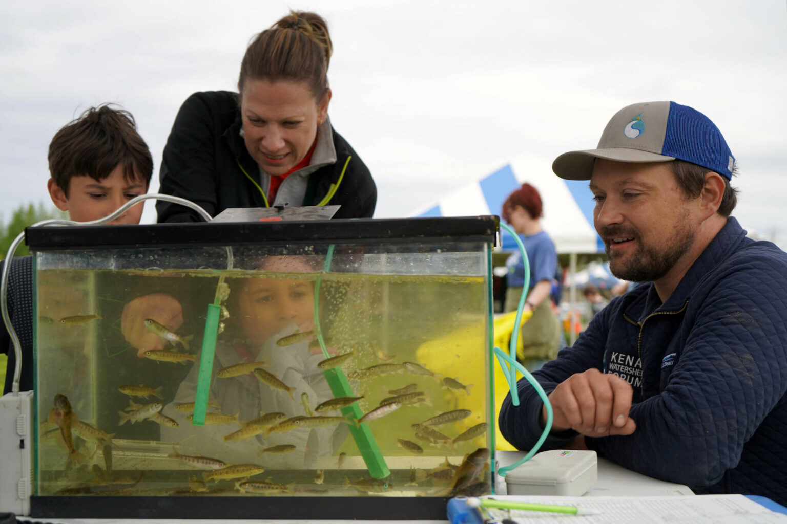
- Education. In 2024 KWF continued to oversee fish sampling events aimed at education and outreach, occurring primarily at Lower Soldotna Creek. These events introduced basic facts about wild salmon life history and habitat to local community members, visitors, journalists, and summer campers. Total participants is estimated in excess of two thousand people, primarily from the Kenai River Fair on June 8th. At this event we displayed juvenile fish in glass aquariums and provided education materials and perspectives to passers-by (Figure 4.4). We also held a similar display at Trout Unlimited Alaska’s riparian restoration event at Centennial Park in Soldotna on June 9th (“Plants for Salmon.”)
Fish Map App. In 2024, Kenai Watershed Forum and it’s volunteers submitted all anadromous waters nominations using the Fish Map App4, a smartphone application developed by a coalition led by the Alaska Conservation Foundation and Indiginous Sentinels Network. The app streamlines the process of recording and preparing field data for Alaskan anadromous water nominations. For each successfully submitted nomination, participants receive a $100 honorarium.
New Grant Proposal. Kenai Watershed Forum was invited to submit a proposal to the National Coastal Resilience Fund to continue and substantially expand the work described in this report. The proposal highlighted the conservation and infrastructure values of documenting anadromous habitat, and how current legal infrastructure at the both the State of Alaska level (statute 16.05.871) and Kenai Peninsula Borough (ordinance 21.18) can help ensure that planners and permit reviewers have better maps for decision making. KWF will be notified in winter 2024 if the proposal is funded.
Electrofishing Training. Two Kenai Watershed Forum staff attended a three-day workshop in Anchorage, AK hosted by the Alaska Chapter of the American Fisheries Society and the Alaska Department of Fish and Game. Staff learned principles of safely using electrofishing tools to survey freshwater streams and lakes, culminating with hands-on field experience.
GIS Training. One Kenai Watershed Forum staff member attended a free two-day workshop hosted by Chickaloon Village Traditional Council at Alaska Pacific University focused on GIS mapping techniques for fish habitat and fish passage. The course provided immediate value to work described in this project to expand the anadromous waters catalog, with practical workflows to manipulate and measure stream layers and communicate results.
Local Habitat Ordinance Updates. Kenai Watershed Forum, along with othe local nonprofits, communicated throughout 2024 with staff from Kenai Peninsula Borough regarding updates to waterbodies managed under borough ordinance 21.18. By statute, the map of 21.18 waterbodies is to be updated ever three years. However, ten years had passed since the previous update. In response, borough staff began reviewing data hosted in ADF&G Anadromous Waters Catalog to verify currency and detail. Where data is sufficiently robust to document presence of anadromous fish, a package proposal to update the 21.18 maps are received for vote by the borough assembly after review by the Lands Committee. In August 2024 these updates were unanimously adopted by the assembly for the southern district of the borough. Updates to the other two borough andromous habitat districts (Northern and Western) are currently in progress. A map of KPB 21.18 districts can be found here.
4.4.3 Predictive Habitat Mapping
As previous years discussion sections have highlighted, the geographic scale of efforts needed to map Alaska’s anadromous waters is so large that continuing to rely on ground-truthing efforts alone will result in additional habitat being disturbed before it is even documented (see 2021 Discussion, “2021 Highlight: Lower Soldotna Creek Tributary.”) Additional rationale and background for this discussion can be found in the two essays posted on Kenai Watershed Forum’s blog post, “Mapping Alaska’s Salmon Streams5.” Two efforts were initiated in 2024 to begin to address the challenge:
Gradient Barrier Mapping. Kenai Watershed Forum and St. Mary’s University of Minnesota Geospatial Services developed a custom approach in ArcGIS Pro to estimate the locations of probable barriers to upstream migration of adult anadromous fish. Following discussion with Alaska Department of Fish and game staff, we used the National Hydrography Database and available LiDAR data to locate the first point upstream with a 16% gradient over 35m distance for all watersheds in the Kenai Peninsula Borough (KPB). We presumed that all stream and lake habitat downstream from these points may be anadromous. With this approach, we estimated a total of 16,474 miles of anadromous stream habitat, a quantity more than three times the 4,898 miles of currently documented miles of anadromous streams in the KPB.
While the above approach is relatively coarse, it highlights the scale of probable undocumented anadromous habitat remaining in the KPB region. Further exploration of this dataset is needed to assess its overlay with known existing anadromous habitat.
- End-of-anadromy mapping. In 2024, the Kenai Peninsula Chapter of Trout Unlimited received an additional Embrace-a-Stream grant to explore remote sensing and analysis innovations around the topic of mapping anadromous waters in the Kenai region. We worked with consultants Romey Fisheries and Aquatic Science to apply “End-of-Anadromy” modeling to watersheds within the boundaries of the Chugach National Forest, following an approach described for watersheds in southeast Alaska (Romey and Martin 2022). In this approach, a multivariate statistical model of landscape and watershed parameters is applied to predicting probable end-of-anadromy locations rather than a single gradient over distance metric. The approach has proven very successful in southeast Alaska, with researchers able to predict the locations of upper extent of anadromy with 98% accuracy with an average error distance of < 67m. We used juvenile coho salmon as the model species.
The predictive habitat maps discussed above are not currently published online in Kenai Wateshed Forum’s ArcGIS Online account, but are available by emailing hydrology (at) kenaiwatershed.org.
Overall, we found that the end of anadromy model that was developed in southeast Alaska did not perform to adequate standards when directly transferred to Kenai region geography. There are likely two main reasons for this result:
Lack of appropriate region-specific model training data. The Kenai modeling effort was based primarily off of fish distribution parameters developed from field surveys performed in southeast Alaska. It is likely that a suite of geographic characteristics unique to southeast Alaska are responsible for spatial distribution, as is the case for the Kenai region. Thus, transferring model parameters from one regional population to another risks misalignment of geographical and biological data. To remedy this issue, anadromous waters surveys in the Kenai region should be conducted following Last Fish Observed protocols (surveying for fish presence/absence in upstream direction until none observed). These data will then be used to train an updated Kenai-specific regional fish distribution model.
Different regional fish populations are adapted to distinct regional geographies. Habitat conditions beyond geographical form also influence fish distribution, and are regionally unique. Environmental drivers relevant to habitat modeling can include water temperature regime, stream flow regime, inter species and intra species competition, and water quality. Model performance will improve by using Kenai-region specific datasets.
An anecdotal example of model under performance for both Gradient Barrier as well as End-of-Anadromy mapping is evident in the segment of Granite Creek in Turnagain Pass nominated in 2024 (Figure 3.1). In this figure, a 4.23 km length of Granite Creek is nominated. However, both predictive maps show probable end of anadromous habitat ending near the Hope Highway cutoff, more than 15 stream kilometers downstream from where we observed anadromous fish. Many other similar examples are evident upon examination, highlighting the need to improve existing predictive maps for the Kenai region.
4.5 2025
The year 2025 was marked by the award of a major grant from the National Coastal Resilience Fund. In spring 2025, we initiated a collaboration with consultants Terrainworks and Romey Riverscape Sciences to explore using predictive habitat modeling to identify the extent of probable anadromous habitat. Further details about these efforts can be accessed on our website at https://www.kenaiwatershed.org/news-media/fish-habitat-mapping-2025/. A full draft-in-progress of methods and scope for this effort is available in a Google Doc; Mapping Anadromous Habitat in the Kenai Peninsula Borough Project Manual 2025 - 2027 [DRAFT].
4.6 Media highlights
4.6.1 Radio
From 2021-2023, KDLL Public Radio published three stories about the work discussed in this report:
“Groups put area’s anadromous fish on the map” (May 27, 2021), reporter Elizabeth Earl
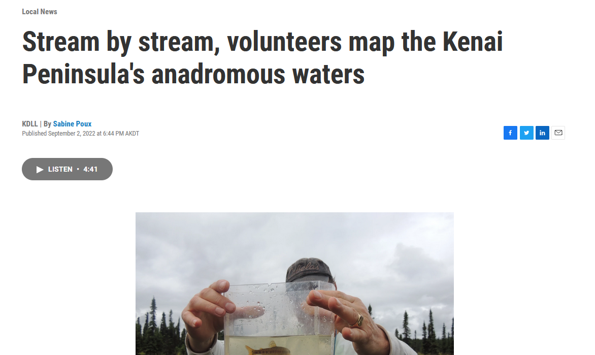
“Stream by stream, volunteers map the Kenai Peninsula’s anadromous waters” (September 2, 2022), reporter Sabine Poux (Figure 4.5)
“‘They don’t necessarily look like salmon habitat’; Kenai Watershed Forum maps the Peninsula’s anadromous waters” (September 18, 2023), reporter Hunter Morrison
4.6.2 Print Media
- Cook Inletkeeper Program Promotes Community Engagement (Peninsula Clarion, November 1, 2025)
4.6.3 Public Lecture
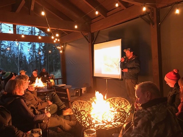
On November 1, 2023, Alexa Millward (Trout Unlimited) and Benjamin Meyer (Kenai Watershed Forum) were featured to present this project as part of Kenai Watershed Forum’s “Fireside Chats” series held at Kenai River Brewing in Soldotna, AK.
Presentation slides available online at this link
Audio lecture available at this link, aired on KDLL Radio’s Kenai Conversation on November 15, 2023
